3. Network Survey Manager
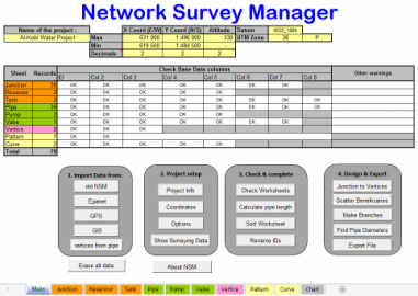
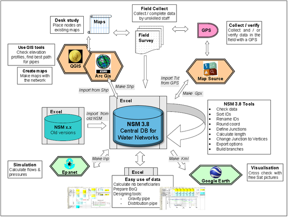
Network Survey Manager (NSM) is a powerful tool in an Excel file, conceived to facilitate the management and data modification of water network, allowing quick transfer to/from Epanet, GIS, GPS or Google earth. It also helps to check the validity of the data and ease the correction, modification and renaming.
- Import data (*.shp, *.gpx, *.inp)
- Setup the project
- Check and complete
- Design and export (*.shp, *.gpx, *.inp, *.klm, *.dxf)
Additional possibilities thanks to the use of Excel :
- modify coordinates of a project (shift, scale or rotate)
- merge different Epanet projects
- quickly built up a BoQ for a project
- add as many information field as desired
- etc..
Updated 25.02.15 : Import Polylines from CAD & KML
Copyright 2014 Laurent Wismer
Licensed under the Apach License, Version 2.0. |
Find the drat of the new manual.
 NSM Manual by Laurent Wismer is licensed under a Creative Commons Attribution-NoDerivatives 4.0 International License. | ||||||||||

Fine tuning have still to be done in the draft version, kindly let me know if you have problems
To use NSM you have to Enable macros in Excel
To use NSM you have to Enable macros in Excel
